Infrastructure & Asset Inspections in Roanoke, VA
Acres & Acreage LLC Of Roanoke, Virginia
Aerial Drone Inspections for Bridges, Roads, Utilities & More
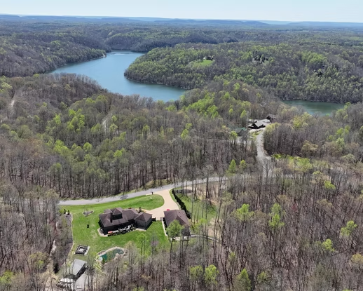
At Acres & Acreage, we specialize in high-precision drone inspections designed to help businesses, municipalities, and contractors efficiently manage and maintain critical infrastructure across Roanoke, Salem, and Southwest Virginia. Our FAA-certified pilots utilize RTK-enabled drones to capture highly accurate, real-time aerial data, ensuring thorough evaluations of bridges, roads, power lines, pipelines, and industrial assets. By leveraging advanced drone technology, we provide faster, safer, and more cost-effective alternatives to traditional surveying methods, reducing manual labor risks, minimizing operational downtime, and delivering comprehensive visual and geospatial insights for better decision-making. Whether you need routine monitoring, pre- and post-construction mapping, or detailed condition assessments, our team at Acres & Acreage In Roanoke ensures that you receive actionable, high-resolution data tailored to your specific infrastructure needs.
Comprehensive Infrastructure Inspection Services In Roanoke
Our teams aerial inspection technology eliminates the need for expensive, time-consuming manual surveys.
Acres & Acreage delivers accurate, high-resolution data for:
Bridge & Roadway Condition Assessments: Identify structural issues, wear, and erosion before they become costly problems.
Utility Corridor Inspections: Monitor power lines, pipelines, and utility infrastructure with precision.
Cell Tower & Industrial Site Documentation: Capture detailed imagery for maintenance, compliance, and asset management.
Pre- & Post-Construction Infrastructure Mapping: Ensure project accuracy with georeferenced aerial data.
Waterway & Environmental Monitoring: Assess flood risks, erosion, and vegetation changes over time.
Why Acres & Acreage For Infrastructure & Asset Inspections
FAA Part 107 Certified Pilots
Accurate Data Collection With RTK-Enabled Drones
Cost-Effective Alternative To Traditional Surveying
Fast Delivery Of Actionable Aerial Data
Benefits of Drone Inspections
High Accuracy:
Maintain asset records over time with consistent, high-resolution imagery.
Faster Turnaround:
Reduce the risks of manual inspections and avoid expensive equipment rentals
Cost-Effective
Reduces labor and equipment costs
Safe & Accessible
Inspect tall structures, remote bridges, and utility corridors without disruption.
Comprehensive Data
Data formatted for direct use in GIS and project planning.
Minimal Environmental Impact
No heavy equipment required, reducing site disruption
Drone Deliverables
High-resolution annotated imagery
2D orthomosaic & 3D models
Detailed asset condition reports
GIS-ready shapefiles & KMZ files
Acres & Acreage: Precision Drone Inspections for Infrastructure & Asset Management
Acres & Acreage: Precision Drone Inspections for Infrastructure & Asset Management
At Acres & Acreage, we provide high-quality drone-based infrastructure inspections across Roanoke, Salem, and Southwest Virginia. Our FAA-certified pilots use advanced RTK-enabled drones to capture precise aerial data, delivering faster, safer, and more cost-effective evaluations compared to traditional inspection methods.
Whether you’re overseeing roads, bridges, power lines, pipelines, or industrial assets, our drone technology ensures detailed condition assessments, historical tracking, and actionable insights to support infrastructure maintenance, compliance, and long-term planning.
Our infrastructure drone inspection services are trusted by:
Construction Firms & Developers – Pre- and post-construction site evaluations, earthwork tracking
Municipalities & Government Agencies – Routine inspections of roads, bridges, and public infrastructure
Utility & Energy Companies – Power line corridor monitoring, pipeline inspections
Industrial & Commercial Facilities – Site documentation, asset management, and environmental compliance
By utilizing high-resolution imagery, 2D/3D mapping, and GIS-compatible data exports, Acres & Acreage helps clients make informed decisions while minimizing risks and operational downtime.
Contact us today to schedule a consultation and see how drone-powered inspections can optimize your infrastructure management.