ACRES & ACREAGE LLC.

Construction Drone Mapping Services

Professional Drone Mapping Services From Acres and Acreage In Roanoke, VA

Construction Drone Mapping Services In Roanoke, Virgnia

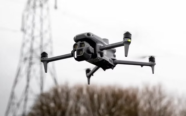
Streamline your construction projects with professional drone mapping services from Acres and Acreage. Our RTK-enabled Matrice 4E drone captures high-resolution aerial data to support site planning, progress tracking, and volumetric analysis.

Drone Services Offered

Pre-construction site surveys with orthomosaic mapping

Earthworks and volumetric calculations

Progress monitoring (weekly, biweekly, or monthly)

As-built documentation for project closeout

Comprehensive Construction Drone Mapping Services In Roanoke, VA

At Acres & Acreage, our construction drone mapping services provide accurate, high-resolution aerial data to streamline your project from start to finish. We offer pre-construction site surveys with detailed orthomosaic mapping, allowing for precise planning and site analysis. Our teams drones also perform earthworks tracking and volumetric calculations to monitor material movement efficiently. With scheduled progress monitoring—whether weekly, biweekly, or monthly—you can stay updated on every phase of development. Additionally, we provide as-built documentation for project closeout, ensuring accurate records for compliance and future reference.

Our Advanced Drone Technology for Precision Mapping In Roanoke, VA

Acres & Acreage utilizes the DJI Matrice 4E with RTK positioning us to deliver survey-grade accuracy for construction drone mapping. This advanced drone technology ensures precise data collection, minimizing errors and enhancing project efficiency. Our data is processed through industry-leading software, including DroneDeploy and QGIS, to generate client-ready deliverables such as high-resolution orthomosaic maps, volumetric calculations, and progress monitoring reports. By combining cutting-edge drone capabilities with powerful post-processing tools, we provide construction professionals with reliable, actionable insights for every stage of their project.

Included Drone Deliverables

2D orthomosaic site map

3D digital terrain models

Cut/fill volume calculations

Interactive time-lapse progress maps

How We Fly Our Drones In Ranoke

At Acres & Acreage, we lead the way in drone-based infrastructure inspections, mapping, real estate photography and videography across Roanoke, Salem, and Southwest Virginia. We don’t just operate drones—we solve problems, providing precise aerial data that helps businesses, developers, and municipalities make informed decisions. Our success comes from combining cutting-edge drone technology with expert piloting, ensuring every project is executed with accuracy and efficiency.

One of the biggest challenges in the drone industry is inconsistency in pilot expertise and data accuracy. At Acres & Acreage in Roanoke, Virginia, we eliminate that concern with a team of FAA-certified pilots trained in advanced aerial imaging techniques. Our pilots aren’t just operators—they’re skilled technicians who know how to capture the right angles, optimize lighting conditions, and use precision flight planning to deliver high-quality results. Whether it’s evaluating infrastructure, tracking construction progress, or showcasing real estate, we fly with purpose, ensuring every aerial capture meets the highest professional standards.

Expert Drone Pilot Services in Roanoke, VA

Our expert drone pilots leverage advanced technology to provide high-precision aerial inspections, mapping, photography and videography. Using state-of-the-art drones like the DJI Matrice 4E and DJI Mini 4 Pro, we capture stable, crystal-clear imagery with unmatched accuracy. Our FAA-certified pilots are skilled in navigating both urban infrastructure and remote landscapes, ensuring reliable data collection for construction, real estate, and asset inspections. Whether assessing a bridge, monitoring land development, or showcasing a property, Acres & Acreage delivers high-quality drone services tailored to your needs.

Scroll to Top